This is one of my articles series that I started with few months ago , where I decided to walk along a Day Trip on each of the main sites in Jordan , So I’ve already posted Petra Day Trip in a Photo ,and that article contains hundreds of detailed photos about Petra , and how is going to look in a quick day trip tour,
then I moved on another day trip in Jordan and visited what is called Little Petra , and created same name article , Little Petra Day Trip in a Photo, and this is my third detailed article about Jerash city , Jerash Day Trip in a Photo Jerash is one of the best-preserved Roman-era cities in the world. Located only 40 kilometers north of Amman, visitors to Jerash today can trace the chariot ruts on the Cardo, admire the mosaics which were laid contemporaneously to those found in Madaba, and test the acoustics of the North and South Theatres. Inhabited since Neolithic times, Jerash came of age when Pompey swept through the region in 63 BC Jerash became one of the largest cities in the Decapolis federation. Today s cultural events, like the Jerash Festival and the Roman chariot races, which take advantage of the unique setting and fantastic acoustics of the restored theatres, bring back some of the excitement and bustle that must have marked Jerash during its heyday.
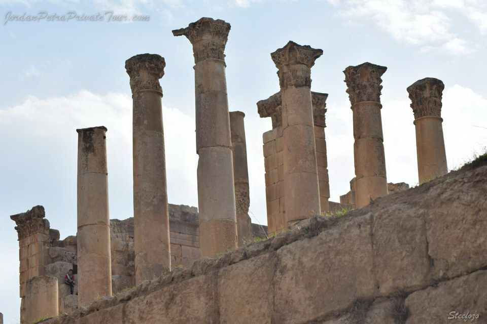
The Church of Marianos (570-749 AD)
According to the perfectly preserved inscription found in the church at Jerash city, it was built in 570 AD under the episcopate of Bishop Marianos, after whom it was named. Much of the geometric –patterned mosaic floor remains intact, offering a lovely example of a typical element of Byzantine church interiors. The plan of this church is quite simple. It is made up of a single nave that is reached through a passage or narthex, that leads there from the entrance. The passage opens out onto the main road that led from Philadelphia to Gerasa. With Jerash day trip you would be able to see this site for sure.
The church sits amid scores of subterranean 1st and 2nd century tombs and was probably built there for or by squatters who occupied the ruins of the hippodrome in the 6th and 7th centuries. It is thought that they were a group of artisans, potters and dyers. Three chambers of the nearby hippodrome were converted into living quarters with mosaic floors, and an inscription adorned with birds tells that this was the residence of a deacon called Elias. The deacon’s house was then abandoned in the early 7th century, more than a century before the church was destroyed by the earthquake of 749 AD. Jerash Day trip is an amazing experience to see the best places in Jerash city.

Jerash Day Trip : The Hippodrome (220 AD -749 AD)
When the Hadrianic project to expand the city over the south necropolis was abandoned, the western side of the Gerasa/Philadelphia road was free to build this hippodrome (which means ‘circus’ in Latin). It is the smallest known hippodrome of the Roman Empire, and also the best preserved; particularly the arched careers , which are the starting gates where the horse would be positioned.
Built for chariot racing, it was 265 meters long and 50 meters wide. The monument was probably completed in the early 3rd century and it could accommodate up to 17,000 spectators. However, it is uncertain as to whether the track was actually ready for use, allowing competition between the “reds”, “greens”,”blues” and “whites , which were the colors worn by competing teams. Walking in Jerash , like taking Jerash day trip would give you the chance to see this site as well.
By the late 4th century the northern part of the hippodrome had been transformed into an amphitheater for gladiator fights and other sports, while the south part was abandoned and squatted by potters.
Between the 6th and 8th centuries this monument was used as a quarry, with materials taken to repair the city wall. At the same time, artisan dyers reused part of the ruins as workshops. In the 8th century the area became the site of the mass graves for the hurried burial of hundreds of victims of a plague. It was the great earthquake of 749 AD that led to final ruin of the Gerasa Hippodrome.

The South Gate and the City Wall (Ca 129/130 AD and 4th century AD)
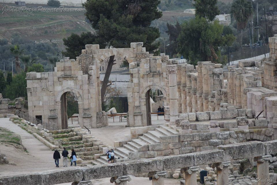
The South Gate is a monumental arch that stands at the southern entrance to the city. Today it is the main way into the an ancient city, but this was not always the case. The vault you see further in, beyond the gate, once marked the entrance to Gerasa, and it sits at the start of the road to the Philadelphia (an ancient for Amman), with Jerash day trip you would be able to watch all the best of Jerash city.
With triple arches flanked by half-columns, notice the similarity between the design of this gate and that of Hadrian’s Arch. Although no dedicatory inscription has been found it is possible that this gate was a prototype for the larger monumental arch. The South Gate may have been built just before the Emperor Hadrian’s visit, and it is therefore likely that was built in his honor.
The gate later became part of the 3.4 kilometer-long Jerash city wall that was constructed at the beginning of the 4th century AD, probably after a group of looters burned and destroyed large parts of Jerash city. Remains do not indicate the existence of any earlier defensive walls, which means that Gerasa would have been an open Jerash city well into early Byzantine times.
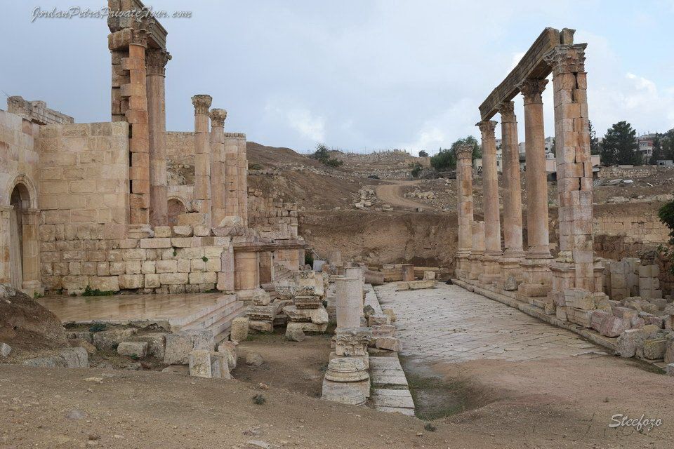
The West Souk and Military Barracks of Jerash
(2nd Cent. AD – end 3th cent. AD, 4th Cent. AD-7th cent. AD)
This area, at the foot of the Temple of Zeus and on the west side of the Gerasa –Philadelphia road, would have been busy with travelers into and out of Jerash city. Thus it was a great commercial location, and in the 2nd century AD at least four shops were set up here. Partly dug out of the rock, the shops were occupied by woodworking craftsmen and many of their tools have been found here. The colonnade in front of the shop supported two small (100 meters squared) but wealthy dwellings above. This entire set of buildings was destroyed in the late 3rd century by a fire set by looters raiding Jerash city.
Following the raid, construction began to fortify Jerash city. It was at this time that the city walls were built. The ruins of the West Souk of Jerash city lay right beside the South Gate, and so these were leveled and the area was used to build a small army barracks around central courtyard. These housed the guards protecting access to the fortification, which were built at the same time in the early 4th century. After being altered several times, the barracks were probably abandoned in the 7th century. Walking in a day trip in Jerash city would be an amazing tour for sure.

The Oil Press (Ca 220 AD- ca300 AD)
In about 220 AD the rocky floor of the southernmost shop of the West was dug into to house an oil mill. The ancient oil press has well preserved and can still be seen here today at Jerash city.
A staircase cut into the rock enabled access to the oil mill from the sidewalk of the West Souk. In the center of the room you can see the stone remains of the crushing wheel machine. The press itself stood in a large niche on the west side, facing olives, whereby in place of the usual lever was a horizontal beam that was lowered by turning two vertical wooden screws. The foundations of Jerash city wall now partly cover the oil mill, indicating that the wall was built after the oil press was destroyed and abandoned.
Various materials and ancient items were unearthed here, including glass, ceramics, bronze lamps iron tools and coins. These revealed that the press area along with the carpenter workshop and house on the floors above at Jerash city were destroyed by a violent fire at the end of the 3rd century. This was during a raid on the city when it was not yet fortified. The city wall was thus built after this time.
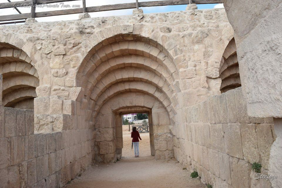
The East Souk and the South Street (Ca 110 AD – ca 300 AD)
In the early 2nd century (around 110 AD) a strip of 15 workshops were built just outside the limit of Jerash city, along the first 50 meters of what was the road that led to Philadelphia (Amman). This was before the South Gate was built, as the foundations of the last shop today lie under the gate. The shops seem to have been occupied by craftsmen, carpenters, pottery merchants and at least one bronze worker, and this market would have served people going into out of Jerash city.
The shops were in use until the late 3rd century when, probably during the looters’ raid, a fire destroyed part of Jerash city including at East Souk. It was then rapidly repaired and briefly reoccupied as shops. Soon after though, at the turn of the 3rd/4th centuries, the souk was deliberately razed to the ground in order to shift the street here to create direct access to the Oval Plaza from the South Gate of Jerash city.
The ruins of the souk were covered by the new South Street that was built on top of them, while the former location of the road was then gradually occupied by artisan workshops until the 749 AD earthquake destroyed the city. You would have the chance to see this in a day trip tour to Jerash for sure.
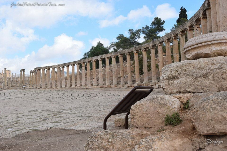
Pic 0038/ The Oval Plaza (Ca 110 AD)
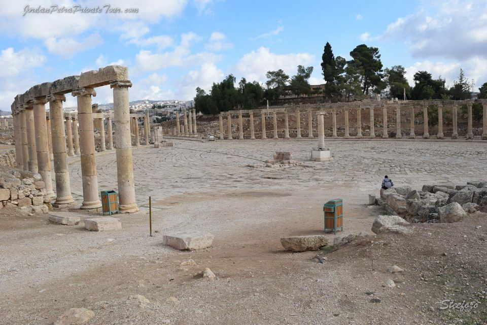
This magnificent Plaza is emblematic of the ancient city of Gerasa in its architecture, its grandeur and its development. The Oval shape is unique and the plaza was actually built to connect the Cardo (the main street of Gerasa / Jerash) with the Sanctuary of Zeus. In effect it is an enlargement of the street; architecture means to join the two axes, which were not aligned, by widening the street in an oval shape in front of the main access point to the sanctuary.
While the plaza and the lonic columns that line the perimeter were probably built in the beginning of the 2nd cent. AD, under the rule of Emperor Trajan, the paving came much later, not before the 4th cent. AD.
Two small monuments decorated the center of this plaza: the first was a base for a group of statues, possibly representing priestesses, which were offered by some high ranking members of the Hadriane-Helios tribe of Gerasa. The second was a small base on which stood four columns – a tetrakionion – which perhaps protected a statue of the emperor Hadrian. A day trip to Jerash city would be more than enough to see this site as well.
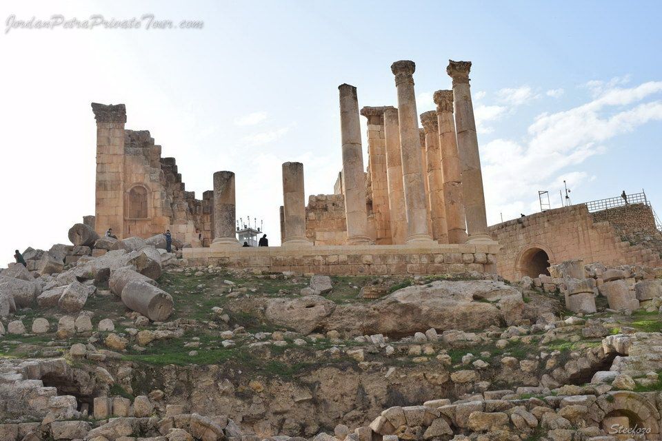
The Great Temple of Zeus (162/163 AD – ca 450 AD
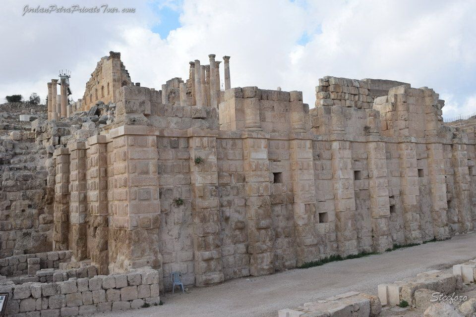
This once grand temple dedicated to Zeus Olympios was built in 162/163 AD. It lies on terrace above the original sanctuary to Zeus, and overlooks the Oval Plaza. The original site of worship, which lay on the terrace beneath, became the Lower Sanctuary of a magnificent temple complex and a wide staircase linked the lower part to this newer upper terrace.
The Great Temple of Zeus stood on a podium surrounded by columns. The plan and ornamentation was in a classic style typical of its time. The façade was marked by eight Corinthian columns and a unique series of niches that decorated the outside walls. A flat roof sheltered the temple.
This temple was complete and was larger than the one dedicated to Artemis, the patron goddess of Gerasa / Jerash. Construction of the Temple of Artemis had begun 15 years earlier, but it was never actually finished. The shifting of work on the city’s main temple from the lower terrace Sanctuary of Zeus to the Temple of Artemis and then back here to the Great Temple of Zeus indicates some strife amid the powers of Jerash city.
In the 5th century AD this temple was taken apart, and it became a quarry of materials used to construct. This is one of best places to see in a day trip to Jerash.
The Church of Saints Peter and Paul (Ca 601 AD-ca 749 AD)
This two-aisled basilica, dedicated to Saints Peter and Paul, was built around the turn of the 6th to 7th century during the episcopate of Anastasius. It had a flat chevet area with three apses. The central of these apses contained a two-tiered synthronon (seats for the members of the clergy), in front of which a reliquary was found. Traces and fragments of decorative marble plaques from a pulpit that protruded into the nave were found in the south-west corner of the choir.
Although it is quite poorly preserved, the mosaic floor of the nave is notable for its representations of the Egyptian cities of Alexandria and Memphis. These are noted in a large dedication found within a dovetail cartouche design.
On the west side of the church an atrium fronted the triple entry, though this is in bad condition today. A chapel was added to the north side of the building at an unknown date. The set of buildings was apparently abandoned (or perhaps inhabited) when it was destroyed – probably by the earthquake.
Church of St. Theodore (494/496 – 749 AD
As with most other churches found in Jerash, this three-aisled basilica was constructed using many stone blocks taken from earlier Roman structure. The main entrance is from the west, consisting of an imposing doorway decorated with intricate carvings and an inscription that says: “….It was built in 494/496 during the episcopate of Aeneas and in honor of the victorious Theodore, immortal martyr”
Inside, the church is divided by two rows of large stone columns. The apse overlooks the Fountain Courtyard below and was flanked by two staircases that led up to it from the Courtyard. Note the well-preserved pulpit for the priest; pieces of carved marble plates that probably decorated it were found here.
Two chapels were later added to the church, one to the north and one to the south, as well as a baptistery is quite well-preserved and consists of a niche that may have been the waiting room, which led to the baptism room, and then an exit. This system would have allowed for more than one person to be baptized at a time.
The church was apparently being refurbished when it was destroyed by the earthquake in 749 AD.
The Temple of Artemis Ca 135 AD-749 AD, 12th century
This temple was built as a shrine to Artemis, who was the patron goddess of Gerasa. It lies inside the large courtyard of the sanctuary. Construction of the temple began in the 2nd century AD, however it was never finished and only 12 columns out of a planned total of 32 were erected.
The temple sits on an extensive system of underground vaults, the exact purpose of which is not known. At the back is an adytum, or an inner shrine, where only the Roman priest would be permitted. It comprises a niche for a deity and two side chambers. One of the chambers has a staircase leading down to the vaults, while the second has a staircase leading up to the roof, indicating that there may have been an altar on top.
The temple was used during later times as well, possibly as a church in the Byzantine era, by potters during Umayyad and in the 12th century it may have used as a fort by a group of Crusaders. This temple is one of the places that you must visit in a day trip / tour to Jerash.
The hydraulic stone saw machine (Ca 550AD)
This water-powered saw is the earliest machine in the world found to date. It was used for cutting large blocks of stone, and is made up of two saws, each with four blades, which were powered by a water mill. Installed in the mid -6th century in one of the underground rooms of the Sanctuary of Artemis, the mechanical saw is the first (discovered to date) to use a crankshaft system, which transformed the circular movement of the water wheel to the horizontal movement of the saws. The machine comprises:
- Two aqueducts (B and B’) that fed a large cistern (C),
- A reservoir (D) to collect overflow from the cistern,
- A vertical channel (E) allowing water to fall approximately 4 meters,
- A mill race (F) with the supports of the horizontal axe of a bucket wheel,
- Two hard limestone column drums showing saw marks (G and G’)
This important find indicates that attempts to mechanize work dates back to antiquity in the Middle East, and not the middle Ages in Europe or China as was previously thought. A working replica of the Byzantine sawmill was prepared in France and assembled on site in Jerash by a group of students from the Delataille Professional Technical School.
The Sanctuary of Artemis (Ca 135 AD – 749 AD, 12th century)
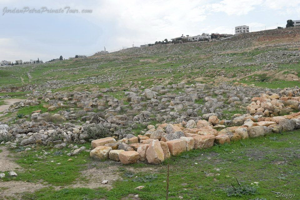
After the East Baths, the sanctuary of Artemis is the largest monument in Gerasa. A temple stands inside the large courtyard that measures 115 by 155 meters and is surrounded by porticoes on all four sides, a typical “Syrian” plan for a sanctuary.
The approach to the temple and its sanctuary would have been quite awe-inspiring. It is perched on a hill at the center of the town, at a tangent to the Cardo. Looking up from the bottom, worshippers would not yet be able to see the temple. To reach it they would undertake a grand ascent, which began at the Cardo facing a monumental propylaeum, or entryway. Beyond this was a large flight of steps that widened at the next level. At the end of the steps was a portico with beautifully decorated columns and façade and beyond this gate laid the courtyard and the Temple of Artemis.
There is no proof at the sanctuary or temple that this was a sacred place or one of worship prior to 135 AD when planning began for this structure. It is likely that the sanctuary was constructed on the site of an earlier necropolis on the orders of Hadrian. Abandoned from the mid- 5th century, it was turned into a quarry and was occupied by potters the Umayyad epoch.
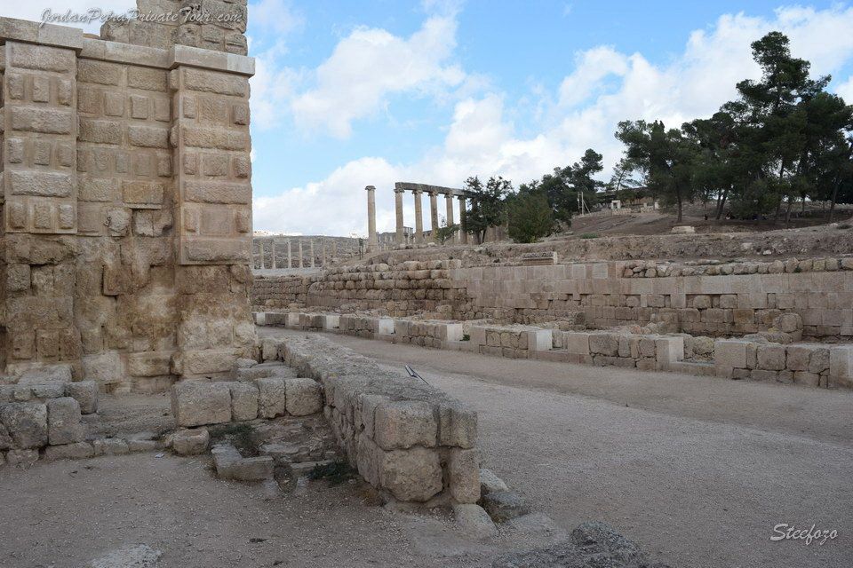
The Ottoman Building (Ca 1910 AD)
The first travelers to visit the ruins of Gerasa – Jerash at the start of the 19th century described the site as completely deserted but dangerous, as it was subject to Bedouin raids.
From 1875, groups of Circassians and Chechens were moved to different points of what was then a province of the Ottoman empire. Amman, Salt and Jerash were thus repopulated.
In Jerash, the colonists settled mostly on the east bank of the wadi where they founded a new village that became the ancestor of the modern town. They built their constructions using stone blocks –some of which were decorated – taken from the ancient monuments on the west bank, which at that time was considered as no more than a source of building materials.
To protect and monitor the new arrivals, the ottoman authorities installed a small garrison here, and this building was built around 1910 on one side of the Propulaea of the Temple of Artemis to house the soldiers.
The Agora and the Civic Basilica (Ca 130 AD – End of the 3rd century Ad)
Although this vast part of the ancient city has not yet been excavated, two key structure have been identified here which here which, along with the nearby North Theatre / Bouleuterion, would have made this the civic center of Jerash, a layout commonly found in the Greco-Roman world. The Agora was an open air meeting place where citizens would assemble and the Basilica was a huge public building that was used for various purposes, including official gatherings, court discussions, and it is possibly where the city archives were stored. In its heyday this part of town would have been bustling with life every day, as citizens and officials alike met and went about their daily business.
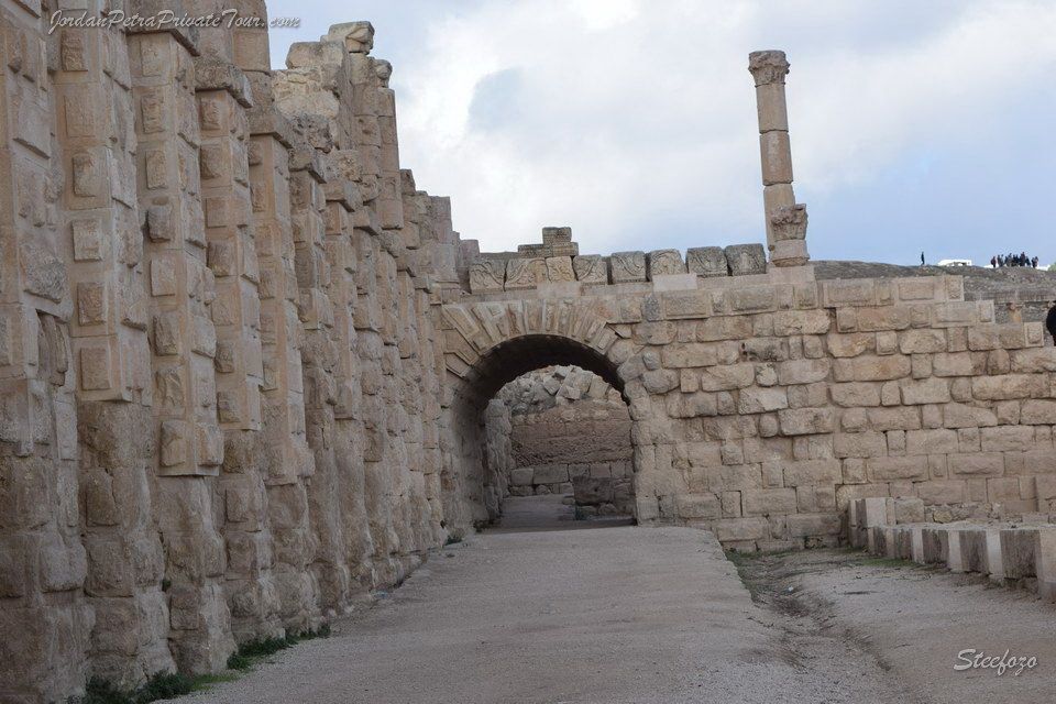
The North Decumanus (Ca 160 AD)
This street runs from the North Theatre through the North Tetrapylon and on to the West Baths. The section between the North Theatre and the Basilica and Agora area is one of the best preserved in all of Jerash, with its cambered road surface and paving stones having remained remarkably well intact, several of the manhole covers along the sewer beneath it even still have their iron lifting rings.
The ionic colonnades bordering the street look identical to those that run along the North end of the Cardo, however they do not date from Trajan’s reign. They were built later from stones most likely recycled from the colonnades of the central part of the main thoroughfare, which would have been dismantled and reused to embellish the North Decumanus when the Cardo was widened in the second half of the 2nd century.
The North Gate and the North end of the Cardo (115 AD – 749 AD)
This arch marked the northern main entrance to the city. It was built in 115 AD, prior to the South Gate. Inscription in the façade dedicate the gate to the “founder of the city”. Emperor Trajan. A unique feature of this gate is its trapezoidal shape. It was built like this to alter shift the axis of the road slightly to the west in order to align it with the city’s Cardo. Otherwise the architecture is simple, with one passageway that served both carriage and pedestrians. Note that the city walls to either side do not link up smoothly, indicating that the gates were built as a freestanding monument and then later included in the fortification walls.
The gate leads into the northern end of the Cardo, which is quite different in structure from the southern part. Here the road is a lot narrower and the sidewalks are simpler. Most noticeably, the colonnades that line this part of the street are shorter and their column are lonic in style, like those of the Oval Plaza. The street here has been preserved in its original form, while further down it was widened and embellished with Corinthian colonnades.
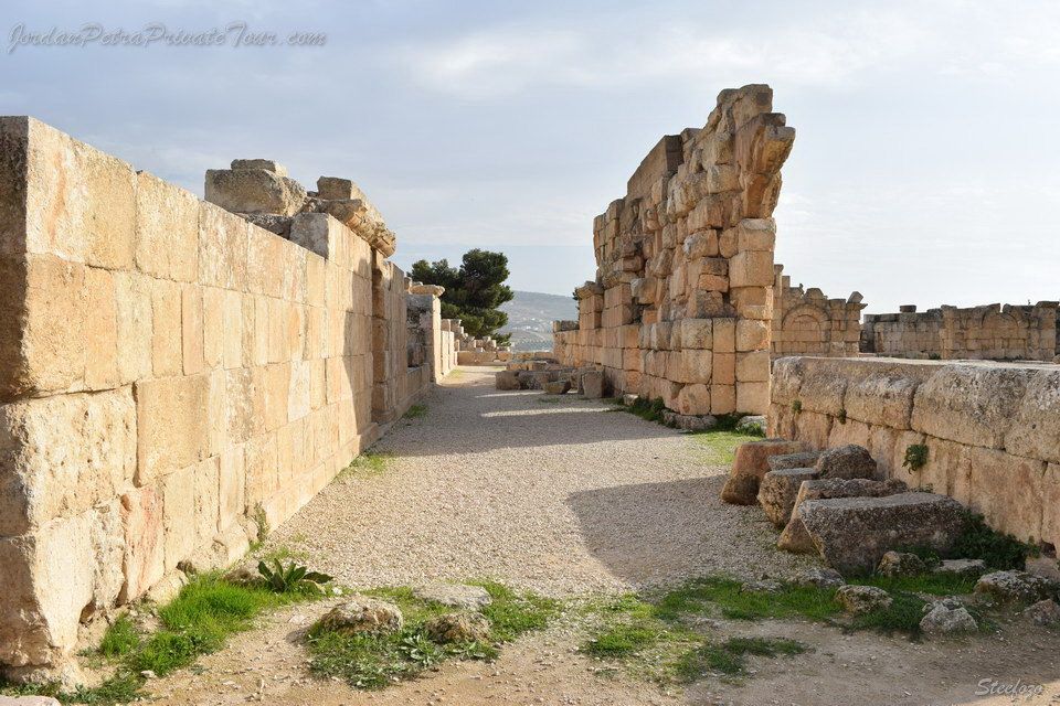
The North Tetrapylon (Ca 165/170 AD- 749 AD)
Lying at the intersection of the Cardo with the North Decumanus, this is a true Tetrapylon – unlike the South Tetrapylon, which comprise four monuments. Tetrapylon means ‘four gates’ and is usually a square – shaped structure with a gate on each side. This one was topped with a dome, the ancient one having been rebuilt to what you see today. The north Tetrapylon was probably erected between 165 and 170 AD, before the Cardo was widened. Its north and south faces were embellished with projecting Corinthian columns that stood on tall bases designed as lion-head fountains, although they don’t seem to have ever operated as they are not connected to any water system.
An inscription was later added beneath one of the niches on the west face of the Tetrapylon to honor the procurator of the province, Decimus Junius Arabians Socrates, and his family. The West façade looks out onto a well-built section of the North Decumanus, which is paved and lined with porticoes and lies in front of the civic center of the city.
The Church of the Propylaea (Ca 565 AD -749 AD)
This was once part of the magnificent tiered entry was to the Sanctuary of Artemis, which began on the east bank of the wadi and consisted of a bridge, arch, colonnaded street, trapezoidal plaza and monumental propylaea. After the bridge connecting the two sides of the wadi collapsed in the middle of the 6th century, this section of the street was transformed into a three – nave basilica.
A tripylon (three doors) that marked the start to the broken bridge was filled in to be an apse, while the Western end of the street (the Cardo side) was closed off with a wall pierced by an axial gateway. The two Corinthian colonnaded of the street were incorporated as supports for the roof of the church. On the west side, preceding the main entrance of the church, the ancient trapezoidal plaza was transformed into an atrium (courtyard with porticoes) that opened onto the Cardo.
It is not known exactly when these transformations were made, but it was certainly before 565 AD, which is when a beautiful mosaic was laid in the diakonia (sacristy), which was itself installed in one of the niches of the trapezoidal plaza.
The church was probably destroyed during the earthquake in 749 AD,
The Propylaeum of the Sanctuary of Artemis (150 AD -749 AD)
This Propylaeum, which in Greek means “before the gate”, was part of the grand and monumental approach to the Temple of Artemis that began on the east bank of the wadi. Worshippers would cross a bridge and then encounter this magnificent gateway. Its four colossal columns were aligned with the colonnades of the street and the entryway was richly decorated and comprised three openings. Behind it is a stairway leading upwards, which is more than 30 meters wide and breaks at a terrace. A second wider stairway followed which stretched 100 meters horizontally and was crowned with a colonnade, of which only a few unstable fragments have survived till today. This colonnade stood in front of the peribolos (the wall at the limit of the sanctuary) that surrounded the temple, but that is now completely destroyed.
The construction of this impressive group of monuments too advantage of the steep they were built on, creating a majestic and breathtaking rise towards the temple. It is an outstanding example of monumental architecture from the 2nd century AD.
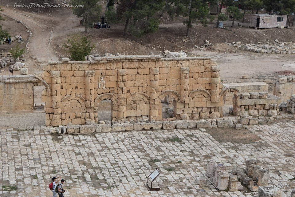
The Nymphaeum (190/191 AD – 749 AD)
As the city of Gerasa thrived and expanded there was a greater need for a substantial and continuous water source within the city. Around 125 AD Gerasa water supply system was built, and by the end of the 2nd century the flow of the main aqueduct was increased to address a growing demand for water following the construction of the baths. This imposing Nymphaeum was then built around 190/191 AD to add a main source of water to the multiple small public fountains that had previously been built along the Xardo.
The Nymphaeum is thus a monumental fountain that served the public s daily water needs. It sits along the main street and consisted of two side aisles which enclosed a central semi-circular apse that was topped with a concrete vault. The two levels of the façade were richly ornamented with a carvings, panels, and Corinthian columns. The lower level was adorned with marble panels and the upper level decorated with painted stucco. Water spouted from the mouths of several carved lion heads into large, deep basin that occupied the entire width of the monument. The water would run continuously, and any overflow was collected by the street s sewage system.
The Cathedral) Ca 450/455 – 749 AD
This is the oldest known Byzantine church in Jerash and was probably built around 450/455 AD when the bishop of Gerasa was Bishop Placcus. The site was previously occupied by a pagan sanctuary, perhaps dedicated to Dionysos, the god of wine. During his reign Bishop Placcus dismantled the Temple of Zeus and used some of the stones for this church, as well as to build the nearby baths named after him. This church was dubbed "the Cathedral" by the American excavation team that unearthed it in 1929.
The wonderful architecture of the Cathedral is still apparent in what remains today. The main entrance to the church is on the west side, from an atrium called the Fountain Courtyard.
Eight other entrances also allowed access to the church and inside the space is partitioned into three sections by two rows of columns with an apse at the front of the church that only the priest would have access to. Note the holes in the columns and walls, which may have been for attaching decorative plaster panels and bronze embellishments.
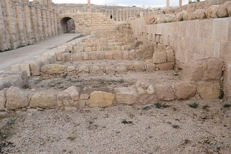
(The Two Bridges over the Chrysorrhoea) Ca 150 AD and ca 170 AD
At this peak the ancient city of Gerasa spanned the two banks of the Chrysorrheus River. The city was first built on the west side of the river and towards the late 2nd century AD it began to expand eastwards, as a result of two bridges that were constructed to link the eastward bank of the river with the western one. Prior to the bridges the east side was mainly devoted to gardens, which were well supplied with water from the Ain Qairawan spring.
The northern bridge was constructed first; its aim was to create monumental access to the Temple of Artemis, as the Cardo was for the Sanctuary of Zeus. The southern bridge was added later. Between constructing each bridge, the Great Eastern Bath was built in late 2nd century.
Excavations on the eastern part of the ancient city have uncovered mainly Byzantine remains, and this indicates that the area became populated at a relatively late period.
Not much of the bridges remain today, although large parts of the ancient round arches of the South Bridge, have survived centuries.
(The Great East Baths) Ca 180 AD – 749 AD
Seven public bathhouses dating from between the 2nd century AD and the Umayyad era have so far been found in Gerasa. While some were only a few dozen square meters in size, the Great East Baths occupied more than 25,000 square meters.
This is the largest landmark in the ancient city and the only major building from the Roman period to have been erected on the eastern bank of the wadi. It lies between the outlets of the two ancient bridges spanning the Chrysorrhoea River. The baths were deliberately built close to the important Ain Qairawan spring.
Set in a vast courtyard surrounded by colonnades, the bath house has vaulted ceilings of dressed stone set in an orderly pattern. It was built in the second half of the 2nd century AD. The North Hall, a series of richly decorated rooms, was added to the north side of the baths in the late 3rd century. This addition reflects the increased importance of the baths in the social political and administrative life of the city. The baths have not been excavated.
The North Hall (Late 3rd century AD-749 AD )
The North Hall is a set of thirteen richly rooms that were added to the East Baths around the late 3rd century. Although the rooms themselves are a physical extension of the baths, the North Hall does not show any evidence of usage as an additional bath, for there is no evidence of a heater or swimming pool. The thirteen rooms are arranged around a long paved central courtyard that is aligned on a west-east axis, perpendicular to the main axis of baths. The North Hall courtyard and surrounding rooms were probably used for gathering, debates, sport, and socializing.
Most rooms open onto the courtyard through wide doorways framed by porticos with Corinthian columns and pilasters. All these columns and pilasters were adorned with one or sometimes two marble or bronze statues portraying either mythical character linked to the cult of Dionysos or political figures, such as emperors and governors. Excavations have revealed many marble statues, some of which are thought to have been taken from monuments in the west side of the city. It is quite possible that after the destruction of the civic center in the 4th century, the North Hall could have served as the temporary civic center of the city. Although this is uncertain, it is clear that the North Hall held considerable social and political significance in ancient Gerasa.
The South Tetrapylon (Ca 200 AD – 6th century AD
The intersection of the two main streets of the city (the Cardo and the South Decumanus ) was marked by a round plaza. At the centre stood a monument, though all that remains of it today are four solid pedestals embellished with niches. Originally, each pedestal supported four columns made of pink granite from Aswan, in Egypt, topped with an emperor or a luxurious import. The four sets of four columns are called tetra kionion.
At the end of the 4th century, pedestals supported statues of the emperors Diocletian, Maximian Hercules, Constantius Chlorus and Galerius – known as the Tetrarchs as they all ruled at the same time between 395 and 406 AD. In the 6th century, several of the granite columns were reused in the construction of the Octagonal Martyrion Church that was built 500m from the ramparts in the North Necropolis.

The South Decumanus (Ca 175 AD)
The Decumanus lies perpendicular to the Cardo, running from East to West, and it was the city’s second major street. It is also one of only two streets that connected both banks of the Chrysorrhoea, the river that passed through the city, which was known as the “river of gold” due to the lush surroundings it watered. The Decumanus crossed over a bridge above the river, and linked to the large bath complex that was built on the east side and today sits within the modern city of Jerash.
Houses that were razed to the ground not earlier than 165 AD were discovered beneath this street, which means it was not built until the second half of the 2nd century. Thus the city planning was certainly Roman, and not of Hellenistic origin. The Decumanus was never finished as it did not fully cross the city, and the porticoes for the Corinthian columns were incomplete. An inscription found on one of the columns close to the bridge mentions that the street’s paving slabs were laid in the 3rd century.
The Umayyad / Abbasid Mosque (Ca 740 -9th century AD)
During the time of Islamic expansion (635 /640 AD) Jerash conceded to Muslim leaders without any destruction being inflicted on the city. Social and economic life continued as usual and Umayyad were minted in Jerash.
When Umayyad rule began here, it is likely that the majority of the city’s population remained Christian while only the administration were Muslims, so a large number of the churches continued to be used. With time, as the population progressively began to convert to Islam, the city needed a mosque. Thus in the first half of the 8th century, probably under the reign of caliph Hisham son of Abd al-Malik (724 /743 AD), a large congregational mosque was built in the heart of the city.
The mosque’s plan is typical of others at that time, consisting of a spacious central open court flanked by porticoes on three sides. The fourth side consisted of a large hall (39x14 meters) used for prayer. It was divided into three naves by two rows of columns, and was built to shelter the worshippers.

The Shops of the South Cardo (2nd century AD- ca 800 AD)
The Cardo was the backbone of ancient Gerasa, where all citizens and visitors would pass regularly as they went about their daily business. So naturally merchants would set up shop that line the city’s busiest street and are situated between the entrances to important buildings. Along the southern part of the Cardo the structure of some of these shops are still visible today, as well as the façades of the eight macellum shops. Originally built in the 2nd century, the South Cardo shops were considerable modified with several additional and unplanned extensions coming later, mainly in the 7th century onwards.
These Umayyad and Abbasid transformations were probably set up by the merchants themselves, despite the wishes of the municipal administration, as the shops eventually completely took over the original sidewalk of the Cardo.
These shops would have been occupied by a variety of merchants, artists, and craftsmen, and would sometimes be grouped together by the type of trade or business. An interesting relic found here is a marble slab with nuskhe Arabic inscriptions that seems to be a shop ledger, listing the amounts owed to the shop owner by customers. It is most likely from the Abbasid period. Another item discovered is an outlandishly designed ceramic pot adorned with rings and horses’ heads, possibly on sale for those residents with more bizarre tastes in art or to show the technical savoir-faire of the potter.
The Cardo (Ca 120 and 170 AD)
The Cardo is the main street of Gerasa, forming the primary axis from which the rest of the city branches out. This 800 meter –Long Street connects the North Gate with the Oval Plaza in a straight line. The street was built at the start of the 2nd century AD and is part of the earlier phases of the city planning. In its heyday it formed the main access to the Sanctuary of Zeus, the city’s most important monument at the time. The Cardo evolved as the city grew, with expansions, sidewalk enlargements and intersections added.
There are many interesting features to note along the Cardo, starting with the columns that line the entire street. The designs, carvings and even the stone used differ, as only few of the columns are the original Roman ones designed for it while most of them were totally rebuilt in the Byzantine era. Large portion of the sidewalks were also modified or rebuilt in the 5th /6th centuries, with stones taken from earlier monuments such as the Temple of Zeus. The limestone paving is marked with grooves left by the repeated passing of chariots. In some places the bedrock appears between the stone. Under the street is a large ancient sewage system, which probably dates to the mid 3rd century.

The Umm al-Rasas Archaeological Park
The ruins of Umm al-Rasas (fig.15). 30 km south –east of Madaba, consist of a walled area forming a fortified camp, and an open quarter of roughly the same size to the north, covering an area of about 3 hectares. The name of the ruins was recorded by the first modern explorer of Jordan. Ulrich Seetzen in 1807. It was first visited by Buckingham in 1816. The explorers who followed. Palmer. Tristram. Brunnow-Domaszewski realized the Christian character of the settlement on the steppe. Fr. Bagatti in 1948 tried to establish a schematic plan of the ruins, focusing on the building with apses identified as churches. In the summer of 1986, with the assistance of the Department of Antiquities, the Franciscan Institute started the archaeological exploration of the ruins. The excavations resulted in one of the most important and exciting discoveries of this century in Jordan for the Byzantine-Umayyad periods.
One of the main results achieved since that first camping, is the historical identification of the ruins of Umm al-Rasas with Kastron Mefaa, a toponym known to the Roman and Arabic sources and to the Bible. The Notitia Dignitatum records that equites promote indigenous, Arab auxiliary troops of the Roman army, were stationed in the camp of Mefa.
The area on the north edge of the ruins chosen for excavation resulted in a large and interconnected liturgical complex with four churches.
The church of Bishop Sergius has been paved with mosaics in AD 587. The eastern church of Saint Stephen (fig. 17) was rebuilt and paved with mosaics in the 8th Century during the Umayyad period by care of the people of Kastron Mefaa and by care of the deacon John chief of the Mefaonites. The inscriptions provide evidence for a flourishing organized urban Christian community in the second half of the 8th Century.
The major artistic interest of the mosaic floor focuses on the double geographical frame depicting cities of Palestine, of Jordan and of Egypt.
Three more mosaiced churches have been excavated in the northern quarter, the church of the Lions (fig.16/18),the church of the priest Wa’il, and the chapel of the Peacocks. The excavation of the church of the Lions on the south east limit of the northern quarter has unraveled another outstanding artistic work of the mosaicists active in Jordan during the Byzantine epoch.